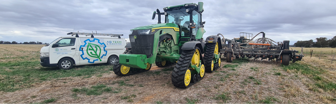
Ag Tech and Machine Data Services
Data services for all your precision ag technology
Data services for all your precision ag technology
Ag Tech and Machine are your partners for all precision ag data.
When you have a new machine and need a data setup, or when you need to update your old system, Ag Tech and Machine will provide data services to get your system running the best it possibly can.
Keep all your machinery and technology running with the most up to date systems, and have the most relevant, precise data possible.
We can help with the following:
- GPS Autosteer
- Farm and Land Surveying
- Application Control Data
- Machine Control Data
- Land forming and Water Management Data
Have you bought a new piece of machinery? Or maybe you just want to optimise your current machinery for efficiency?
The Ag Tech and Machine team can help you create a proper farm > field > event structure from your existing data, so all your boundaries and AB line guides are there as a fresh canvas for your machinery.
With more new machinery taking advantage of mapped boundaries to autosteer and apply valuable inputs, it pays to be prepared by having the correct structure in place, so you can save time, utilise the data later and keep track of the correct documentation.
WATER MANAGEMENT AND DRAINAGE SERVICES
Are you experiencing:
Waterlogging?
Yield loss?
Drainage issues?
Or perhaps you’re looking at:
Irrigation Development?
The drainage or topography issues of a farming property you’re looking to buy (pre-purchase evaluations)?
Save time, water and money with an individualised irrigation water management and drainage solution.
If you are a broadacre farmer or a horticulturalist looking to set up a drainage and water management system, or looking to improve efficiency of the water and drainage manage system you have in place, Ag Tech and Machine will plan, design and implement a custom system for you and your own farm.

What Ag Tech and Machine can do for you:
Ag Tech and Machine will consult with you to establish your own individual needs on your farm, and tailor a custom irrigation water management and drainage solution, as well as assisting you to implement this plan using the latest technology available on the market.
Our Process:
Initial Consultation:
Ag Tech and Machine will consult with you remotely or on farm to talk about your own water management and drainage plan, and discuss your own individual needs for your own farm. This is not a cookie-cutter approach, and your plans will be tailored for exactly what you need on your farm. With extensive knowledge of broadacre farming and horticulture, we can discuss how we can help you achieve your water efficiency goals. We take a holistic approach to your farming systems, and look at your overall goals and plans for your farm.
Create a 3D model of your farm:
Ag Tech and Machine can go to your farm and capture data from your farm using GPS to create a 3D model of your farm. In conjunction with your water and drainage efficiency goals on your farm, we use the 3D model of your farm to inform an individualised water management and drainage plan. With the data from the 3D model of your farm, we can analyse the issues with drainage and water management on your farm, and plan solutions to improve your water and drainage efficiency.
Create a custom plan for your farm:
Using our cutting-edge software and extensive experience and knowledge in the agriculture industry, we use your farm’s 3D plan to custom build a tailor-made plan for your farm’s water management and drainage solution. We consult with the farmer throughout this process to ensure that the plan will meet the individualised needs of every farmer.
3D land forming:
Each of our individualised tailor-made plans includes the data and information you need to implement a 3D land forming plan which results in an optimised solution to get the most efficient use of inputs; water, time, and fuel with minimal disturbance to your daily farm operations. With this plan in our hands, we convert your 3D surface model of your field into a machine control file for the farmer or contractor to use to implement the water and drainage plan, and go out in the field to create the physical changes necessary.
Whether you’re transitioning into new machinery or doing farm management (e.g. boundary lines set up, drainage and water management planning, infrastructure work etc.), field surveying and data collection are critical to get a base established correctly to ensure that decisions are made accurately the first time and avoid costly reworks.
The Ag Tech and Machine team will arrive onsite and collect data to capture all field information (e.g. boundaries, trees, drainage points etc.) required for the design and planning stages, such as for GPS Data Management and/or Water Management .

Our process includes the following steps:
- Discussion stage
- Analyse what your project needs are
- Plan how to best capture the data when out in the field
- Collect the data on site
- Post-analyse the data
- Clean the data for a presentable format
- Documentation and project delivery
Depending on your project needs, we can then use the data for:
GPS Data Management
Water Management
Have you bought a new piece of machinery? Or do you have an incompatible data file from an outside contractor?
No matter where you are based, we can take many existing data formats and convert them into a file type compatible with your machinery for easy and efficient guidance and automation.
Talk to Ag Tech and Machine about data services today
Give us a call to discuss your data needs today